

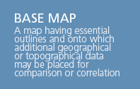
Just about every professional surveyor has been in these shoes. You attend a conference or technology summit and a “new” mapping technology is presented that is touted to develop base maps faster, cheaper, and without a survey. With all the hype, what technology will get you the results you need to Get It Surveyed?
Survey Equipment – Pros & Cons
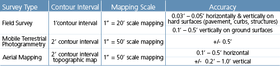
Mobile Terrestrial Photogrammetry is the latest technology I have heard of that offers a solution. It is kind of like Google Earth; hundreds of simultaneously taken photographs are used create stereo images that can be processed, geo-referenced, and used to create base maps. At the end of the conference presentation, we learned the accuracy of the final mapping is plus or minus 0.5 foot or, put another way, it is within one half-foot of actual horizontal and vertical position. Not good enough for design, but good enough for a roadside inventory. Maybe it will get there one day, but in my opinion, it’s a technology with limited application.
What about Aerial – Light Distance and Ranging (LIDAR)? After all, it produces what is euphemistically titled a “bare earth model.” Studies, and my personal experience, have found that LIDAR is appropriate for use on hard surfaces where elevation results can match or sometimes exceed aerial photogrammetry results. But, if your project is forested, overgrown with brush or blackberries or even tall pasture grass, the “bare earth model” derived by LIDAR can be significantly degraded, sometimes by several feet. If you are calculating earthwork quantities, can you risk being off by feet?
Mobile and Terrestrial Laser scanning is a fairly recent entrant in the mapping world that has shown great promise. Similar to LIDAR, it is a good tool for hard surfaces, such as pavement and, if performed with sufficient-quality survey control, the resulting mapping is quite accurate. However, it has similar limitations when it comes to tall grass and heavy brush such as roadway shoulders with scotch broom.

The Best Way to GIS
Aerial mapping has been around for more than 100 years and is a proven technology that is built on survey-provided orientation parameter. Surface features from aerial mapping generally meet FGDC standards (the Federal Geospatial Data Committee is the U.S. interagency committee that promotes the coordinated development, use, sharing, and dissemination of geospatial data on a national basis.).
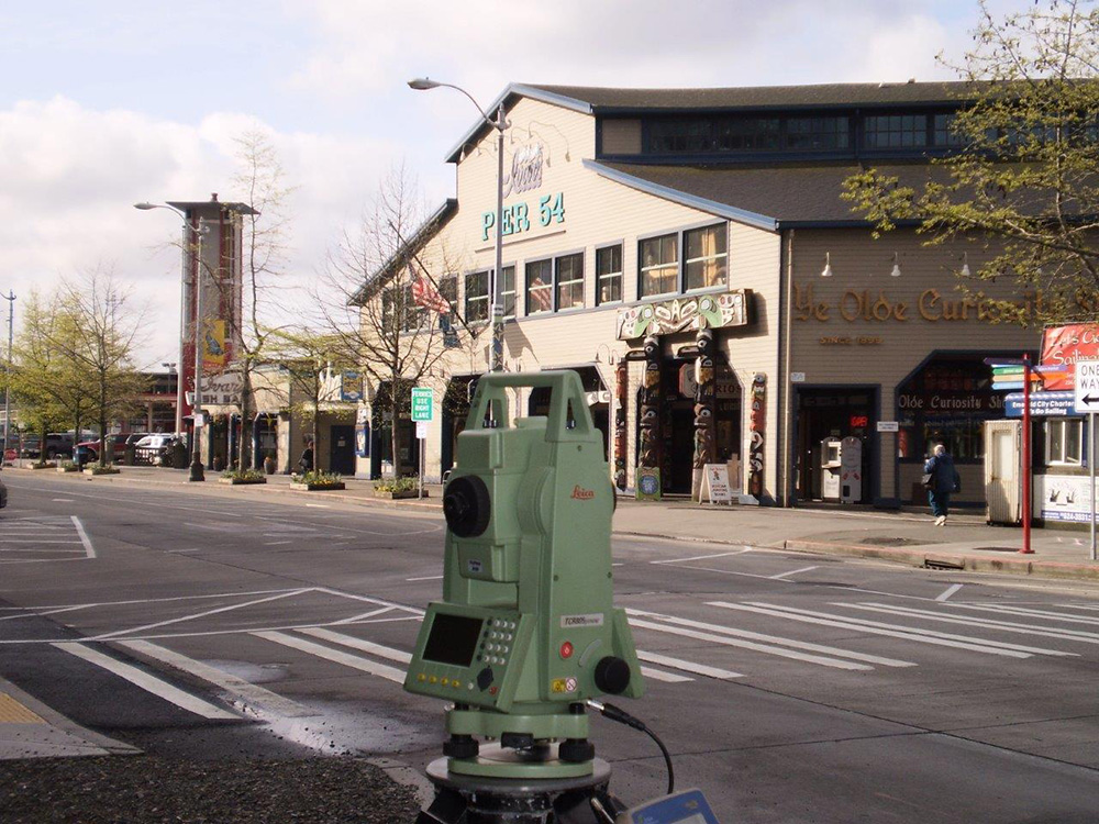
Field survey, on the other hand, achieves a much higher accuracy that can be achieved using standard optical survey instruments. With the more efficient and cost-effective technological advances in survey equipment that are available, Robotic Total Stations (RTS) routinely meet those tolerance specifications. RTS is an unmanned optical survey instrument controlled by a single field person who collects survey measurements while the instrument automatically follows his or her movements.
In my opinion, new technologies have their place and should be considered as a means to supplement ground survey, but the answer is still, “GIS – GET IT SURVEYED!”
GIS = Get it Surveyed borrowed from an LSAW session by Les Olson, PL
 About Our Author: A lifelong practitioner in the Northwest, Mike heads up Reid Middleton’s survey team, supporting a wide range of public and private clients. His broad array of programmatic studies includes transportation and utility corridors, city-wide control networks and GIS inventories.